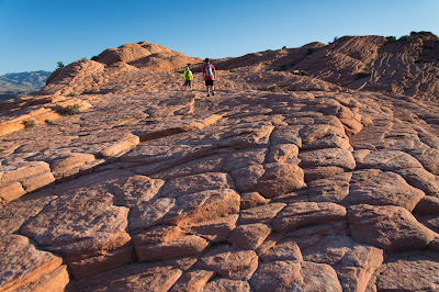
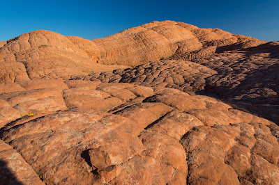
As much as I love National Parks, I also love being reminded that there's plenty of beauty to be found outside of them. That was the case the day after my trip to Zion when Zak and I went out at sunrise with a group from Movara Fitness Resort to hike the Camelback Trail.
The dry climate means early morning temperatures are downright comfortable. Having a knowledgeable guide to lead the way was just icing on the cake.
The human brain excels at picking out patterns, even when they don't necessarily exist. Like the bison our guide pointed out to us on this cliff wall.
The landscape was terrific -- fantastically textured and barren. Zak, as usual, seemed like he could hike forever. I'm always impressed at his stamina. Ah, to be 15!
I could have spent hours shooting all the interesting compositions. Everywhere I looked was another view I could just lose myself in.
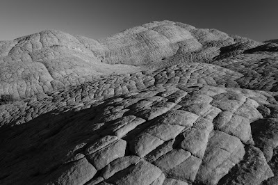
And as stunning as they are in color, this one just blows me away in black and white.
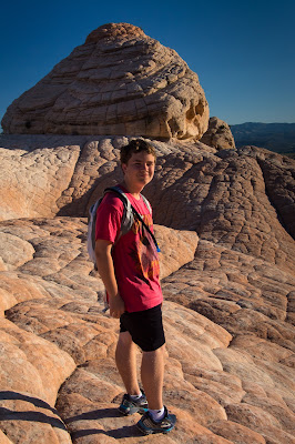
The signature feature of the hike is a whirlpool-shaped depression called The Vortex. Being uptight about having people in my pictures I didn't even take a shot of it from the outside because of all the other hikers in our group, something I regret in hindsight. I did get one of Zak after we'd scrambled down inside, amid all the documentation of past visitors.
The trail is named after these two hump-shaped formations which were our turnaround point.
Zak and I and a few other hardy souls scrambled up to the top of one. Being from Colorado, it's ingrained in us that a hike ends with a summit.
And while the summit may not have been as lofty as some others, it was no less satisfying to reach it.
A 3.3-mile hike, with just 400 feet of elevation gain. I really don't know how long it took us to finish, because we had no schedule to meet. We stopped frequently to talk, to take pictures, to rest, to laugh. I hope I can remember to savor all the time I spend in God's creation as much as I did this hike!
Photos from one guy's travels around the world -- from UNESCO World Heritage Sites to national parks to his own backyard in Colorado, and lots of places in between.
Showing posts with label Zak. Show all posts
Showing posts with label Zak. Show all posts
Saturday, September 3, 2016
Thursday, August 6, 2015
Black Canyon of the Gunnison, June 2015
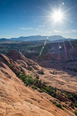
After a rainy visit to Rocky Mountain National Park, the wet weather followed me and Zak to Crested Butte. After lying fairly low our first day in town, the forecast called for a break in the clouds on our second. So we made plans to visit Black Canyon of the Gunnison National Park.
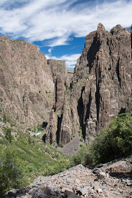
My only previous trip to the park had been nearly five years earlier, in October 2010. Conditions were much more green and lush this time of year. And the morning view to the east from Tomichi Point provided evidence of how the place had gotten its name, as sunlight struggled to reach down the steep canyon walls.
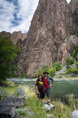
I'd planned to simply drive the South Rim and stop at the various overlooks. But Zak surprised me by wanting to hike the Gunnison Route down into the canyon. I eagerly agreed, and down we went.
The descent was harder than I'd remembered. I had to pack up one of my cameras to free one of my hands to assist. But I kept out my D5200 with the wide angle lens so I could occasionally stop to capture views like this one.
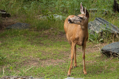
We took a lengthy break down along the river, and were joined briefly by a grazing mule deer doe. If she'd been facing me, I'd be tempted to believe her stuck-out tongue was an expression of her opinion of photographers.
The hike extended our stay longer than I'd planned. But the forecast afternoon clouds didn't materialize.
Zak's ability to wear a hoodie in high temperatures and when exerting himself physically without passing out borders on the mystical. I, on the other hand, sweat like a pig -- especially on the climb back out. And for all the camera gear I was lugging around, I failed to bring a bandana.
Needing both hands on our ascent, I packed up both my cameras for the return trek. Carrying an extra 15 pounds of my body and another 10 or so on my body than I had five years earlier did not help me with the hike. I had to stop frequently to catch my breath on the way up. But we still made it up and down in the 2 1/2 hours the ranger had told us it would take. Not counting our 40-minute break at the bottom, of course.
In other news, I'm now on a diet and have dropped seven pounds in the last two weeks. I'll be better prepared the next time a demanding hike opportunity presents itself!
Topics and References:
Black Canyon of the Gunnison National Park,
Hiking,
Mammals,
Montrose County,
Photos,
Summer,
Zak
Tuesday, April 7, 2015
Big Bend National Park: Dagger Flat Auto Trail
The last day of my spring break road trip with Zak was mainly a driving day. It was a long eight hours in the car from Terlingua to home. But we made time for one more swing into Big Bend National Park to do the Dagger Flat Auto Trail -- a 14-mile round-trip drive through the Chihuahuan Desert.
There's a little stand at the start of the drive with a 16-page guide that you can get for a dollar donation. Totally worth it. The guide corresponds to numbered posts along the route, most of which align with specific flora like this strawberry pitaya.
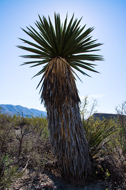
The drive is named for a unique forest of Giant Dagger Yuccas, which can reach 30 feet in height. I asked Zak to pose by one to provide some scale. Then I asked him to look like he was enjoying himself.
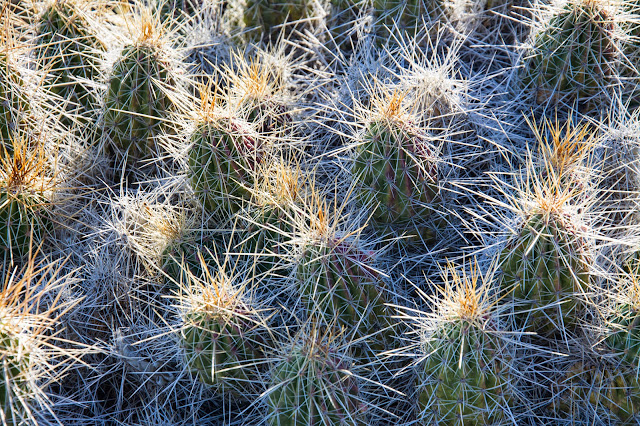
As good as the guide is, I couldn't find an ID for this cactus. I'll e-mail the park and see if a ranger can help.
EDIT: The National Park Service says it's a rainbow cactus.
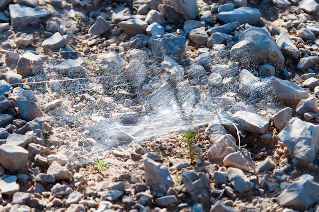
When you wander off trail a bit -- or off-road, in this case -- you often see stuff that you'd otherwise miss such as this spider web. I'll also ask for some help identifying who the builder might be.
EDIT: NPS says probably a trap-door spider.
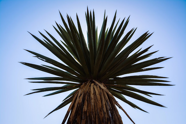
With the Giant Dagger Yuccas being so big and tall, it's fairly easy to position them between yourself and the sun to get nice silhouettes like this ...
... or like this, if you prefer some context.
Yet another image of something I can't positively identify -- a red-flowered yucca, the specific species of which I'm not sure. Torrey Yucca, perhaps?
EDIT: NPS confirms: Torrey Yucca.
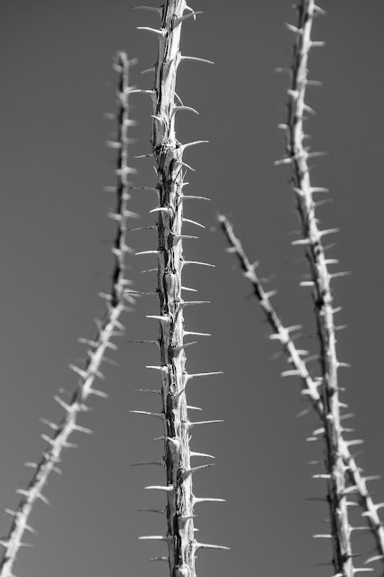
This one I know -- Ocotillo. Most of the year the plant appears to be nothing but a cluster of thorny stalks like these. But with adequate rain, they produce bright green leaves that allow for a growth spurt. When the soil dries, the leaves drop off to conserve moisture. Nature!
The drive takes about two hours on a narrow, winding dirt road. And we didn't see another soul the entire time. A great end to a great trip!
Topics and References:
Big Bend National Park,
Brewster County,
Photos,
Texas,
Winter,
Zak
Location:
Big Bend National Park, TX 79834, USA
Sunday, March 15, 2015
Carlsbad Caverns: Big Room Tour, Part I
Sunday morning bright and early we were back at the Visitor Center, first in line at the elevator to go down to the Big Room per the advice of the very helpful ranger the day before. That advice turned out to be spot on.
There were about 20 visitors total at 8:30 to start touring the Big Room. Once Zak and I let them all move on ahead of us, it felt like we practically had the place to ourselves. For the next two hours, we ran into more rangers than other tourists. That gave me ample opportunity to set up my tripod on the narrow trail, composing and recomposing my shots without feeling like I was interfering with anyone else's visit.
As much as I enjoyed the Natural Entrance Tour the afternoon before, I don't think I shot it well. We'd driven nearly eight hours to get there, so fatigue was a factor. I also prefer to exclude man-made elements from my photos, which works out fine when shooting familiar scenery. But underground it left many shots without any frame of reference for scale. So I made an effort this day to more frequently include some sort of visual guide like the railings in this shot. They provide some nice leading lines, too.
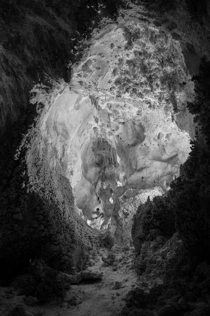
Finally, I decided to convert everything to black and white in post-production. With all the light artificial anyway, any vibrant colors were mostly artifacts of the long exposures. The textures, shapes and contrasts are all what deserve highlighting.
My mop-headed son playing the part of silhouette model. We didn't purchase the audio tour, and probably should have so I'd better understand what exactly marker 24 was intended to bring focus to. Even without that aid, I had little problem appreciating the subterranean beauty.
Seeing places like this always strengthens my belief in an Almighty Creator. Not because I can't accept the science that attempts to explain how these sorts of landscapes can occur "naturally." More because I have no other explanation for how they make me feel. The appreciation of beauty doesn't help me secure a mate, or improve my offspring's chances of survival. It just makes me love God more for giving human beings that gift.
The aptly named Hall of Giants features the largest stalagmite ever discovered -- the so-called Giant Dome. It measures 16 feet in diameter and stands 62 feet high next to two smaller columns known as the Twin Domes.
Stalactite City. That's not the actual name of this room; I just like alliteration.
The Chandelier and the Totem Pole. And not even halfway through the tour yet!
Click here for Part II.
Topics and References:
Carlsbad Caverns National Park,
Eddy County,
Hiking,
New Mexico,
Photos,
UNESCO World Heritage site,
Winter,
Zak
Monday, September 8, 2014
Dayton Area
Zak, Taryn and I flew up to Ohio to visit my mom and her husband this weekend. The trip was a great, relaxing visit. It's awesome for the kids to spend time with their grandparents, and vice versa. And we got out to visit some area attractions and snap a few pictures!
Every time I see thistles I'm drawn to them. Their color, texture and the way they stand out from their surroundings always catch my attention.
Visiting the Miamisburg Mound on Saturday was very reminiscent of our time at Brú na Bóinne in Ireland, a comparison I definitely pointed out to the kids.
The closest NPS unit is the Dayton Aviation Heritage National Historical Park, which commemorates both the Wright Brothers and poet Paul Laurence Dunbar. On the overcast day, blooms in the community garden made great photo subjects.
A whimsical garden decoration fit perfectly with the site theme.
Taryn commented that these blooms looked like they'd been tie-dyed.
Our day wasn't done, as we swung by the Aullwood Audubon Center to take a short walk on one of their trails. Rains from the previous night had still left droplets on some of the wildflower petals.
The kids enjoyed the chance to skip some rocks in the Greater Miami River.
Sunday morning Taryn and I went searching for a place to shoot the sunrise. My mom had mentioned that the Taylorsville MetroPark was especially pretty, so we went there. We had to park outside the gates, which didn't open until 8:00. Then we hiked a short trail to the river, which I neglected to anticipate would be too low and too wooded for seeing the actual sun break the horizon. Nonetheless, the mist made for a striking scene.
Taryn commented that the park reminded her of Costa Rica. I know she was referring to the humidity and dense vegetation, which was epitomized by things like a mushroom growing from a fallen tree.
Driving back to my mom's house over the Taylorsville Dam I noticed that the mist we'd seen earlier down on the river was even thicker. So I pulled over to see if I could get a view with the sun in it from this higher vantage point and was rewarded with this gorgeous scene.
Today we made one more visit to the Aullwood Audubon Center before catching our flight home. Taryn and I took a brief walk through the woods that included something irresistible to her -- a fallen log over a body of water.
A wonderful time with family, and wonderful getting to see some beautiful parts of the Dayton area!
Saturday, July 26, 2014
Staunton State Park
Got Zak and Ginny out for a hike today. Destination: Staunton State Park to do the 10.8-mile roundtrip trek to the Elk Falls Overlook, which was validated as an excellent choice by the guy at the Chick-fil-A drive-through window when we picked up breakfast.
Forecast called for thunderstorms rolling in fairly early. So hitting the trailhead around 10:30 seemed like we would be racing the weather. I took advantage of the good weather at the start to shoot some wildflowers like this milk thistle, figuring I might have the cameras in the backpack before too long.
Alpine Goldenrod with a helpful pollinator, if not necessarily an attractive one.
Black Eyed Susan, which I've been told my Aunt Susie referred as a "Black-Eyed Me" when she was a little girl.
Bee balm with a diligent bumblebee. Clouds had rolled in at this point and I couldn't quite get the depth of field I wanted in the lower light.
Mariposa Lily.
Richardson's Geranium.
It actually takes at least three trails to get to the overlook. This peaceful creek runs alongside the Bugling Elk Trail.
We had our heaviest rain right when we got to the overlook. And as much I hate to say it, I was underwhelmed by the view. The falls are around 300 feet tall, but more than a quarter of a mile away. Didn't really get a view or a good photo.
Zak and Ginny did give me a pose when the rain abated a bit. But with thunder still rumbling we didn't stick around up at 9,150 feet too long.
Fortunately, the clouds moved in a different direction than the one we were heading and we had some nice sun when we got back to Elk Falls Pond.
Zak has figured out how best to spend time while I'm fiddling with my camera. Of course, it does leave him vulnerable to shots like this one.
The pond was pretty, and other folks were taking advantage of the unexpected afternoon sun to just relax on its shore.
The park is just a little more than a year old, and everything from the facilities to the trail signs is still nice and shiny. Homespun touches like this are nice, too.
As final resting places go, this rusting piece of old farming equipment didn't do too badly.
We kept nervously checking the skies, but managed to get back to the car with just a few random sprinkles. Despite a bit of a disappointing payoff at the overlook the hike was great. Only about 1,000 feet of elevation gain and very few steep stretches, well-maintained trails, and of course the beautiful Colorado outdoors. And just a 40-minute drive from our house. I recommend paying a visit!
Topics and References:
Flowers,
Ginny,
Hiking,
Insects,
Jefferson County,
Photos,
Summer,
Waterfalls,
Zak
Subscribe to:
Posts (Atom)


