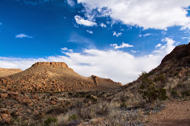
Big Bend National Park is a photo opportunity everywhere you look. From river to desert to mountain, the landscapes never stop showing you something beautiful. These views all made me glad to be alive, and honored to have the chance to drink them in.
Mule Ears Peaks are a unique formation, with a name clearly indicative of the time period in which they were discovered. I can think of many things they resemble more than mule ears. But by any name, they command your attention.
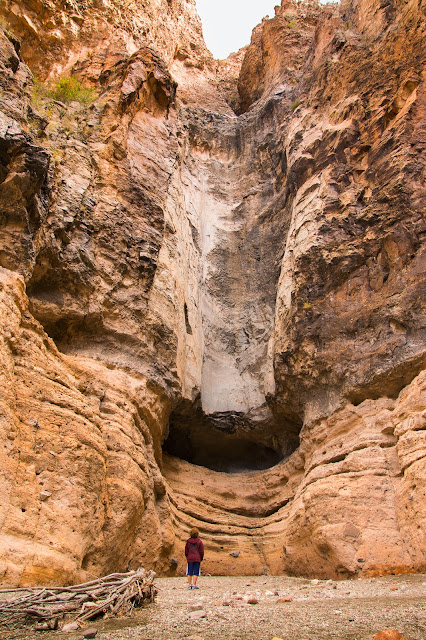
The trail to the Burro Mesa Pouroff is a great chance to experience a desert canyon hike without having to get far into the backcountry. It's just a mile roundtrip.
The pouroff itself is impressive even when dry. I didn't realize it was possible to climb to that small cave about 15 feet up, and wish Zak and I had done it.
We really were blessed with gorgeous weather while in the park -- warm temperatures, and clouds that always added a little interest to the sky.
We wrapped up Tuesday with a hike to Balanced Rock -- our fourth hike of the day, which ended up totaling about 10 miles. Doing several shorter hikes instead of one long one really gave us an opportunity to experience a great cross-section of the park.
Balanced Rock itself lives up to its name. We reached it just after the sun had descended below the ridge to our south, but still got a splendid scene.
I hope I get the chance to return to this gorgeous area. But no matter how many times I do, I'll never forget this first visit with my son. I hope he remembers it as fondly as I will.
Photos from one guy's travels around the world -- from UNESCO World Heritage Sites to national parks to his own backyard in Colorado, and lots of places in between.
Showing posts with label Brewster County. Show all posts
Showing posts with label Brewster County. Show all posts
Sunday, April 12, 2015
Big Bend National Park: Scenic Views
Topics and References:
Big Bend National Park,
Brewster County,
Hiking,
Photos,
Texas,
Winter
Location:
Big Bend National Park, TX 79834, USA
Friday, April 10, 2015
Big Bend National Park: Flora & Fauna
Some of the wonderful things Zak and I saw in Big Bend National Park weren't on hikes or at marked points of interest. They were just right out our window as we were driving by, resulting in numerous instances of slammed brakes, three-point u-turns and blinking hazard lights as we pulled off the road for a closer look.
The first bluebonnets I'd seen this year were just starting to bloom in the park. Rather than try and capture a vast expanse of them, I attempted instead to bring out the beauty of a lone isolated flower.
This Phainopepla was a real treat. I spotted him as we were driving by Sam Nail Ranch. Another lady also pulled off and was slowly creeping closer for a shot when he flew off. She asked excitedly if I'd gotten him, and I appreciated her genuine enthusiasm for someone to have a good photo even if it wasn't her.
Yucca flower along Grapevine Hills Road. The late afternoon sun gave it some nice lighting.
Curve-billed Thrasher. The only color to speak of in the shot is the bird's orange eye. Displaying it in black and white brings more attention to the three-forked tree branch and texture in the feathers.
We saw about a dozen jackrabbits along the Old Maverick Road on our way to Santa Elena Canyon. But since it was before dawn, there was no chance of getting a decent shot of them. This fellow was just south of the Persimmon Gap Visitor Center as we were leaving the park for the final time, bidding us a fond farewell as he nonchalantly chewed on his stalk. Check out the blood vessels in those ears!
We'd long since left the park and were nearing the outskirts of Fort Stockton when we passed some fresh roadkill and a turkey vulture who was already at work cleaning it up. He didn't stray too far from his meal, keeping a wary eye on it and me.
What a treat to have so many unexpected finds on our trip!
Topics and References:
Big Bend National Park,
Birds,
Brewster County,
Flowers,
Mammals,
Photos,
Texas,
Winter
Location:
Big Bend National Park, TX 79834, USA
Tuesday, April 7, 2015
Big Bend National Park: Dagger Flat Auto Trail
The last day of my spring break road trip with Zak was mainly a driving day. It was a long eight hours in the car from Terlingua to home. But we made time for one more swing into Big Bend National Park to do the Dagger Flat Auto Trail -- a 14-mile round-trip drive through the Chihuahuan Desert.
There's a little stand at the start of the drive with a 16-page guide that you can get for a dollar donation. Totally worth it. The guide corresponds to numbered posts along the route, most of which align with specific flora like this strawberry pitaya.
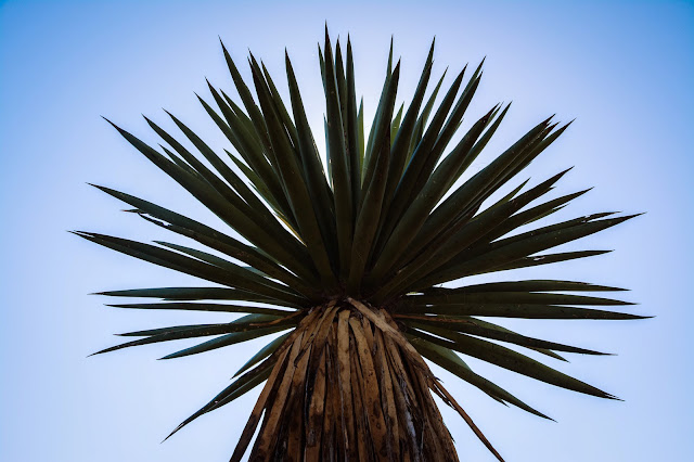
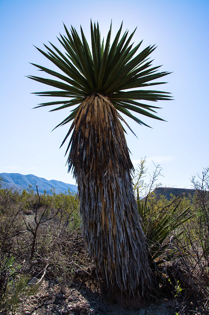
The drive is named for a unique forest of Giant Dagger Yuccas, which can reach 30 feet in height. I asked Zak to pose by one to provide some scale. Then I asked him to look like he was enjoying himself.
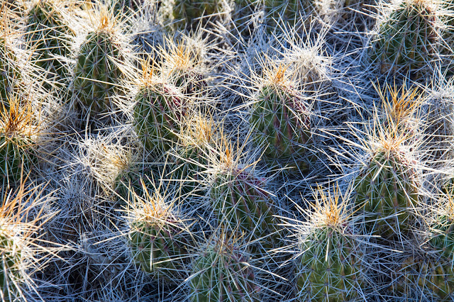
As good as the guide is, I couldn't find an ID for this cactus. I'll e-mail the park and see if a ranger can help.
EDIT: The National Park Service says it's a rainbow cactus.
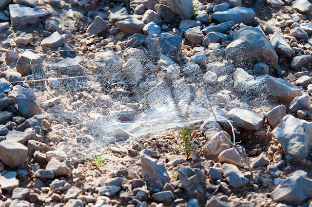
When you wander off trail a bit -- or off-road, in this case -- you often see stuff that you'd otherwise miss such as this spider web. I'll also ask for some help identifying who the builder might be.
EDIT: NPS says probably a trap-door spider.
With the Giant Dagger Yuccas being so big and tall, it's fairly easy to position them between yourself and the sun to get nice silhouettes like this ...
... or like this, if you prefer some context.
Yet another image of something I can't positively identify -- a red-flowered yucca, the specific species of which I'm not sure. Torrey Yucca, perhaps?
EDIT: NPS confirms: Torrey Yucca.
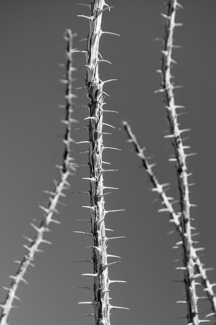
This one I know -- Ocotillo. Most of the year the plant appears to be nothing but a cluster of thorny stalks like these. But with adequate rain, they produce bright green leaves that allow for a growth spurt. When the soil dries, the leaves drop off to conserve moisture. Nature!
The drive takes about two hours on a narrow, winding dirt road. And we didn't see another soul the entire time. A great end to a great trip!
Topics and References:
Big Bend National Park,
Brewster County,
Photos,
Texas,
Winter,
Zak
Location:
Big Bend National Park, TX 79834, USA
Sunday, April 5, 2015
Big Bend National Park: Window Trail
After a great sunrise hike in Santa Elena Canyon, Zak and I drove gradually northeastward through Big Bend National Park. Our destination was the Chisos Basin to next hike the Window Trail.
More helpful advice from a ranger -- the trail is 5.6 miles roundtrip with 980 feet of elevation change if you start at the visitor center. However, starting at the Basin Campground reduces the distance to 4.4 miles roundtrip and the elevation drop to 500 feet. We opted for the latter option.
We overheard a ranger tell another visitor that the desert was as green now as it would be all year thanks to a wet winter. Not everything was growing yet, though. And dead plants against a cloudy sky look best to me rendered in black and white.
On one of the several crossings of Oak Creek along the trail we found ourselves in the midst of at least four Tufted Titmice. None were willing to give me a clean shot. This partially obscured image is the best I could manage. After a few minutes stalking them in hopes of getting a clear view, I decided to give up the chase and continue the hike.
I like to greet people along hiking trails and occasionally strike up conversations. As we neared a trail split, a group coming from the opposite direction advised that we take the upper route for about a quarter of a mile to reach a better outlook to the west than we'd get at the actual Window. So we did, and were suitably impressed.
Retracing our steps and rejoining the Window Trail soon brought us to some slickrock with carved steps marking the best path through.
Then abruptly we were at The Window, and its 220-foot pour-off. No railings, no fence, no sign. Just a few steps away from certain death. Despite being in less danger than standing the same distance from, say, a four-lane highway it still created a queasiness. But a stunning one.
Fueled by Fluffernutters and Gatorade we covered the distance in about three hours, which is pretty solid for me given my frequent photo stops. Sunset was still a good three hours off, so there was more yet to be seen!
Topics and References:
Big Bend National Park,
Birds,
Brewster County,
Hiking,
Photos,
Texas,
Winter
Tuesday, March 31, 2015
Big Bend National Park: Santa Elena Canyon
Since Zak had been such a good sport about coming on our spring break road trip, I decided to only make him get up to catch one sunrise. We chose Santa Elena Canyon for that honor, figuring we could then spend the rest of the day meandering gradually eastward through the rest of Big Bend National Park.
We timed our arrival at the trailhead in time to see the moon still shining above the canyon, with the sun still below the horizon.
Predawn can be stunning, and this morning was no exception. The colors in the sky look almost like some crazy '70s blacklight poster.
We climbed the trail to get to a higher vantage point for the actual moment when the sun crested the horizon, with the Rio Grande down below us and the Chisos Mountains far off in the distance.
The warm light bathed the entrance to the canyon in gold.
Not surprisingly, contrast was a challenge in the canyon. I tried blending two exposures together for this composite image -- my first time applying that technique. I wish the saturation was a little better, and the western wall still not quite so bright. I'll definitely be practicing this more.
On our way back out of the canyon I played peek-a-boo with the sun for a while, trying to get a nice star burst effect without letting the foreground and midground get too underexposed. Mission accomplished!
One last look back into the canyon before continuing on with our day. I like the three folks heading toward the canoe, who both provide scale and ramp up the "wilderness adventure" feeling of this shot.
The trail is a very manageable 1.7 miles roundtrip. Your heart only gets pumping on a brief but steep ascent up the canyon wall. But it's completely worth it to get in deep enough to where it's just you, the water and the cliffs. A fantastic start to the day!
Topics and References:
Big Bend National Park,
Brewster County,
Hiking,
Photos,
Reflections,
Sunrise,
Texas,
Winter
Sunday, March 29, 2015
Big Bend National Park: Storms & Sunsets
The clouds were very, very kind to me on the first afternoon in Big Bend National Park. They allowed the sky -- which could have been a big, blank slab of blue -- to perfectly complement the gorgeous scenery we were seeing on the ground.
Storm clouds over the Chisos Mountains.
A rainbow formed over the Sierra del Carmen range. I was just barely able to catch a quick shot of it before it faded away. I normally think of speed being important when shooting wildlife, but sometimes with landscapes the light can be fleeting. This was one of those times.
A great deal of the afternoon was spent looking for places to shoot the sunset, and wondering if the clouds would get thick enough that there wouldn't even be a sunset to shoot.
God rays always amaze and delight me. If a sunset wasn't going to be in the cards, I was still getting a great show.
I've seen many articles encouraging landscape photographers to deviate from the wide angle lens sometimes and use a telephoto. My 18-105 gave me the ability to do both with this scene, and for that I was very glad.
When sunset did arrive, our patience was rewarded. We set up shop at a vantage point recommended by a ranger at the Panther Junction Visitor Center -- and let me interrupt myself just to say that when a ranger gives you a recommendation, follow it -- and got some nice color and textures over the Chisos Mountains. The pullout is just past mile marker 6 on the road from Panther Junction to Rio Grande Village, if you happen to be in the area.
I almost got a little too single-minded about shooting what was in front of me. A few peeks over my shoulder revealed lovely colors on storm clouds to the southeast. But I just barely shifted and composed in time to catch these rosy hues as the sun disappeared below the horizon.
A truly fantastic introduction to the park. You don't get conditions in the sky like this very often, or for an extended period of time like we did. I hope I managed to do them at least a little justice.
Topics and References:
Big Bend National Park,
Brewster County,
Photos,
Rainbow,
Sunset,
Texas,
Winter
Location:
Big Bend National Park, TX 79834, USA
Friday, March 27, 2015
Big Bend National Park: Journey & Arrival
In less than 48 hours, Zak and I had made two visits to both Carlsbad Caverns National Park and Guadalupe Mountains National Park. The third leg of our spring break stool lay roughly 240 miles almost due south -- Big Bend National Park.
We enjoyed good weather for most of the four-hour drive, with the exception of our pass through Marfa where we went through a small storm. Fortunately, we had plenty of advance notice of it.
It must be nice to completely own the market for something ubiquitous, as the Aermotor Windmill Company has since 1892. The company was actually founded in 1888, but sold only 24 units that first year. Four years later that number had skyrocketed to 20,000, and the landscape of the arid plains and deserts of the United States would never be the same.
Soon enough we arrived in the town of Terlingua. I expected it to be quirky, and was immediately reassured by this piece of roadside art.
I think this formation is Study Butte, but I can't find confirmation online of that. Only that there's a community called Study Butte just east of Terlingua. I assume it's named for this ... butte.
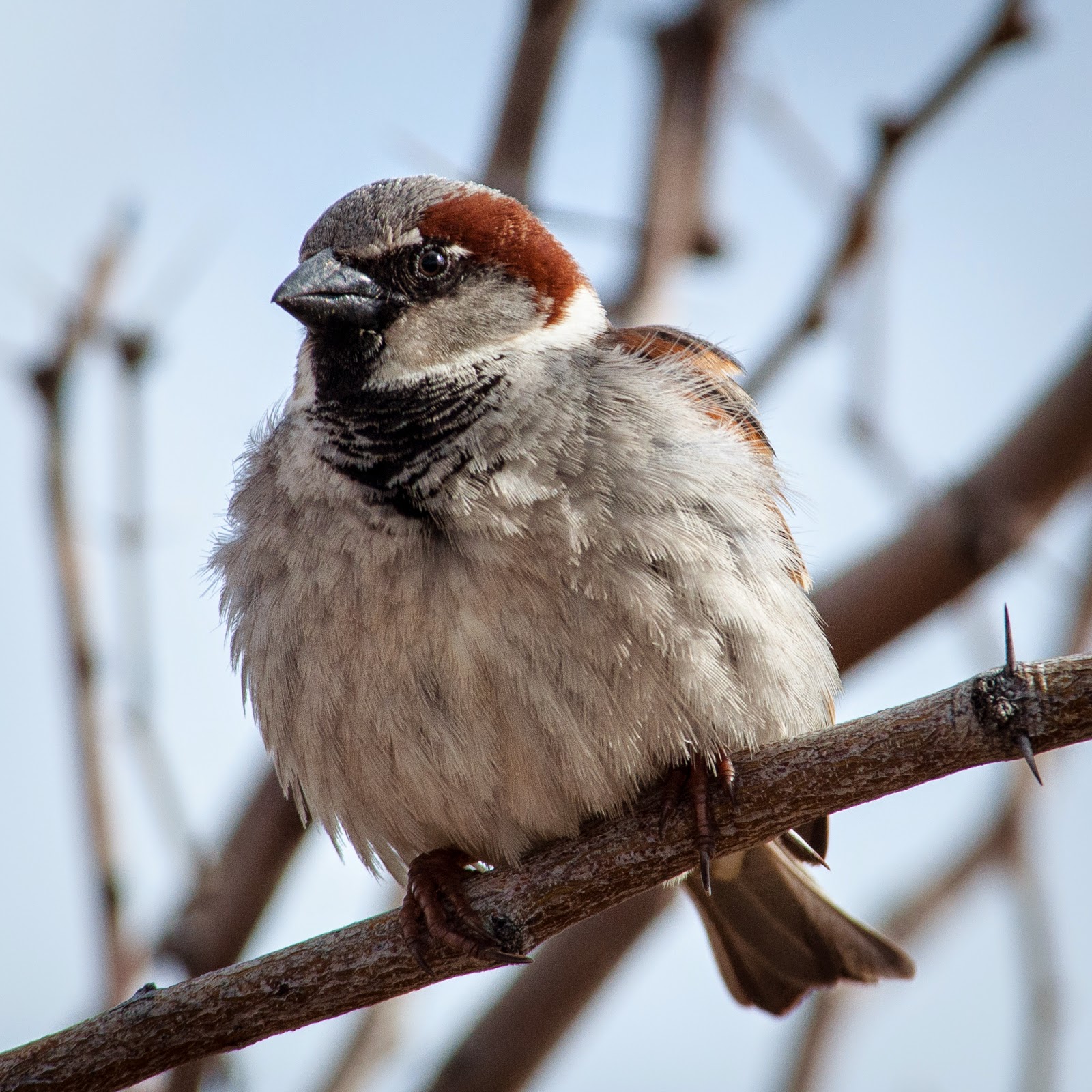
More wildlife of the not-especially-wild variety -- a House Sparrow just outside the Panther Junction Visitor Center.
After a helpful discussion with a ranger (Is there any other kind?), we decided to head down to Boquillas Crossing to check out the Rio Grande and evaluate the area as a possible spot for shooting the sunset. The river was a little less "grande" than I'd expected -- narrow and shallow enough that we saw a fellow cross on a mule. But it definitely cut a beautiful swath through the arid landscape.
Much more to come!
Topics and References:
Big Bend National Park,
Birds,
Brewster County,
Photos,
Texas,
Winter
Location:
Big Bend National Park, TX 79834, USA
Subscribe to:
Posts (Atom)


