Showing posts with label Summit County. Show all posts

Tuesday, March 18, 2025

North Tenmile Trail

With spring just a few days away, time is running out for a hike in the snow this year.  This being spring break week I had the time to find and take one.  It was harder than I expected to identify a location within an acceptable driving distance from home where I had a high confidence of true winter hiking conditions.  Not surprisingly, Summit County came to my rescue.

North Tenmile Trail
The North Tenmile Trail seemed promising based on recent AllTrails reports, and when I arrived at the trailhead I felt like I'd made the right call.  Lots of snow, but the trail itself was packed down enough that I didn't need snowshoes... OR SO I THOUGHT. (Editor's Note: Foreshadowing is a sign of quality entertainment.)

North Tenmile Trail
The sun was REALLY trying to burn through the light cloud cover when I started.  The forecast had called for partly sunny skies, so this was about right.

North Tenmile Trail
The sun eventually broke through, and I got nice light to shoot a few spots along North Tenmile Creek.

North Tenmile Trail
I love scenes where you can get so many beautiful elements in one shot.

North Tenmile Trail
After a couple of miles the snow grew deeper and the tracks grew fewer.  I didn't bring snowshoes with me, and did end up postholing more than I would have liked.  I had just one set of snowshoe tracks to follow from someone who'd apparently gotten an earlier start than I had.

North Tenmile Trail
The payoff at the end of the trail is... this sign.  Not exactly what I expect from Colorado hikes, where a lake, waterfall, or summit typically awaits at the trail's end to reward you for your efforts.  Ah, well.

North Tenmile Trail
The return hike was made somewhat easier by the snow having now been trod upon three times.  That enabled me to make up some of the time I'd lost struggling on the way out.

North Tenmile Trail
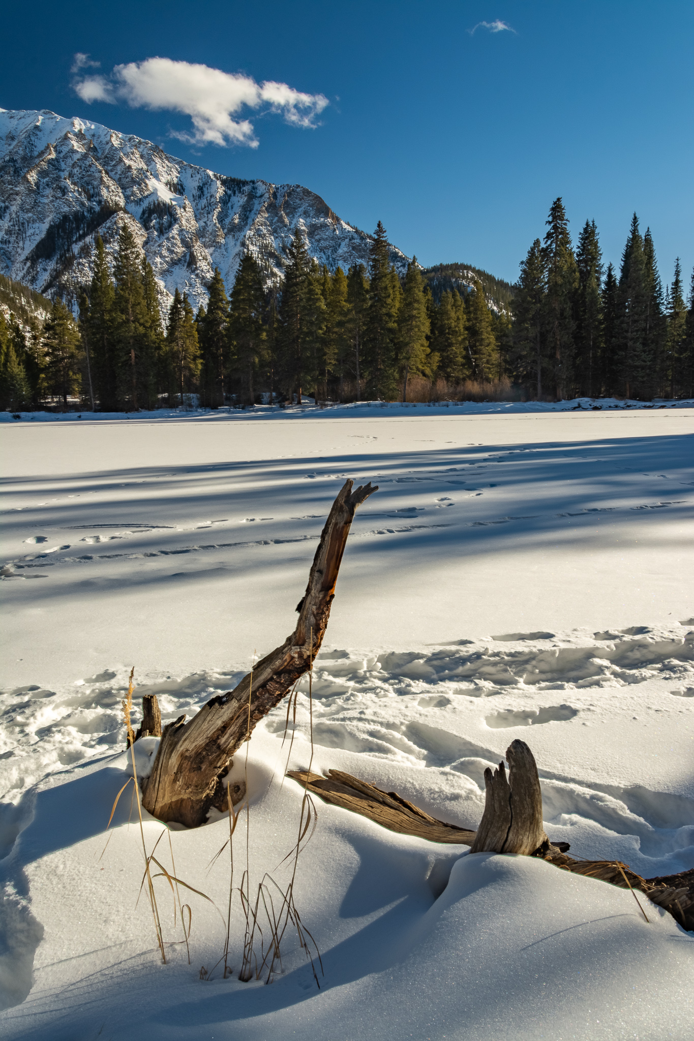
I don't typically care for much of the "hand of man" in my nature shots.  But for some reason tracks in the snow seem different.  It may be the bit of context they provide, or the subtle indication of the effort put in to get the shot.

It took me a longer-than-expected four hours to cover the seven miles, especially considering the trail only has about 990 feet of elevation gain.  I blame the deep snow more than anything else -- it took me nearly an hour to cover the final mile to the turnaround point.  Whatever the reason, it was still exactly the hike I had hoped for!

Monday, December 26, 2022

Summit County

My annual December pilgrimage to Colorado -- with the sole exception being the COVID year of 2021 -- is as much to experience winter as anything.  I mean winter, which to me must include snow.  So imagine my disappoint when Zak and I arrived in the Denver area on December 18 to find things looking and feeling much like they did back in Texas -- 50-degree weather and everything a shade of dormant brown.

Fortunately, I knew a short drive west would provide that which I sought.  A quick Google search of winter photo spots yielded a location I had never visited -- Officers Gulch just past Frisco on I-70.  So on Monday afternoon, that's where I went. 

Officers Gulch
The spot is indeed beautiful.  But I was reminded of something I had forgot about the Colorado high country.  The sun starts to set really early in the winter.  Admittedly, winter was still two days away.  But that just meant I was only two days away from the shortest day -- and earliest sunset -- of the year.  So at 2:30 the surrounding peaks were already casting long shadows.

Officers Gulch
I did the best I could, and silently vowed to come back another time.  But I was still unfulfilled.

Lake Dillon Overlook
Fortunately, I got to drive right by the Dillon Reservoir scenic overlook.  The late afternoon sun was lighting things up beautifully.  This was a slightly more fulfilling sight!

Lake Dillon Overlook
As always, a view that's beautiful in landscape mode tends to also be gorgeous in portrait mode.  I was feeling considerably more fulfilled, but knew with a slight detour I could definitely see some winter conditions.

Loveland Pass
So I veered off of I-70 and took Route 6 to Loveland Pass.  And atop the pass, winter awaited.

Loveland Pass
The sun was getting quite low, but I managed to get some final shots to the north and south.  And with that, I had all the winter I would find for the afternoon.

Monday, July 4, 2016

Grays Peak and Torreys Peak

I hadn't successfully climbed a 14er since San Luis Peak back in 2012. Weather conditions near the summit forced us to abort an attempt at Mt. Sherman in 2014. So when the opportunity arose to do Grays Peak and Torreys Peak on my current visit to Colorado, I took it!

Grays Peak and Torreys Peak
My former WellBiz Brands colleagues Alicia Miller and Travis Little -- who were part of the aforementioned ill-fated assault on Sherman -- also came on this trek.  The forecast called for mostly sunny skies, but when we hit the trail at 8 a.m. the summits of both peaks were enshrouded in clouds.

Torreys Peak
A seasonal stream gave a nice reflection of Torreys Peak and the clouds.

Grays Peak Trail
A couple of hours into the ascent the clouds had begun to break up and sun was peeking through.  Some alpine wildflowers were in full bloom.

Yearling Mountain Goat, Grays Peak
We had a real treat along the upper switchbacks to Grays -- three yearling mountain goats grazing along the trail.  This one was also in a bit of a playful mood, bounding among the rocks.

Marmots, Grays Peak
We reached the top of Grays about four hours in, where we were greeted by some sunbathing yellow-bellied marmots.  They seemed pretty comfortable until one of their buddies elsewhere on the summit gave a warning chirp, at which point they quickly scampered off.

Torreys Peak
The original plan had always been to summit both Grays and its nearby neighbor Torreys, which I was glad about since on my one previous climb of Grays it was snowing heavily when we reached the ascent, causing us to head straight back down.  Conditions on this day couldn't have been more ideal -- warm temperatures and no threatening storm clouds to be seen.  So despite some misgivings about the route to Torreys being a little steep, we agreed that there would never be a better chance to bag the peak.

View From the Saddle Between Grays Peak and Torreys Peak
The view from the saddle between the two mountains was stunning -- just a perfect blend of green vegetation, stark rocks, blue skies, puffy clouds, and even some patches of remaining snow.

Grays Peak
The decision to press on was the right one.  Even going at a fairly slow pace -- well, Travis and I were moving slowly anyway -- we still reached the top of Torreys quicker than we expected and took in the view back to Grays.

Mother and Baby Mountain Goat, Torreys Peak
We weren't alone on Torreys, either.  A curious baby mountain goat and its protective mother kept an eye on our descent.

Grays Peak and Torreys Peak
Looking back on the peaks as we neared the end of our hike it was clear to see how the weather had improved as the day wore on.  Both summits were clearly visible and bright sunlight bathed the valley.

Rocky Mountain Columbine
It was nice to see columbines again.  This lone blossom stood out nicely from its darker background.

We actually had to park more than half a mile from the trailhead since many other folks had the same idea that we did and got an earlier start.  So our total round-trip distance ended up being close to 10 miles.  Stopping for pictures, enjoying some summit beers that Travis had thoughtfully carried in his backpack, and generally moving at a fairly leisurely pace throughout the day had us finish in almost exactly nine hours.  So the length of a typical workday, but with a lot more nature.

That's four 14ers for me now, having also done Mt. Bierstadt back in 1997.  Only 49 to go, and at my current pace of four every 19 years I should finish in the year 2154 when I'm 185 years old.  It's good to have goals!

Wednesday, September 24, 2014

Ptarmigan Peak Trail

It's an amazing season for fall foliage here in Colorado -- the best in recent memory. So I'm trying to squeeze in as many trips to as many different places as I can while things are peaking. Yesterday, that meant the Ptarmigan Peak Trail in Summit County.

Fall Foliage in Silverthorne
One of the great things about a lot of Summit County hikes is that they're very easy to get to, usually pretty close to I-70.  That can also be a drawback, as you can hear the traffic from the highway and see signs of the civilization that you're typically trying to get away from.  Still, the view down to Silverthorne and Lake Dillon from the trailhead is pretty beautiful.

Ptarmigan Peak Trail
The aspens here were definitely peaking.  And providing a nice rule-of-thirds image.

Ptarmigan Peak Trail
The forecast called for a mix of clouds and sun, and that was definitely the case.

Ptarmigan Peak Trail
Those conditions forced me to work a little harder than I had on the Ben Tyler Trail last week, as the light was constantly changing.  A break in the clouds created some nice contrast on this section of the trail.

Ptarmigan Peak Trail
I was fortunate to have good light when I reached this view to the west.

Ptarmigan Peak Trail
I love how these trees are still leafed out, but the trail is also covered in a golden carpet of its own.

Ptarmigan Peak Trail
The trail alternates nicely between thick forest and scenic overlooks.

Ptarmigan Peak Trail
Another great view to the southwest, though a little more subdued with the sun behind some clouds.

Ptarmigan Peak Trail
I kept climbing as long as I could before I needed to turn back to be in time to meet Taryn when she got home from school.  Fortunately, I'd gotten high enough to now have a great view to the north.  There's quite a bit of beetle-kill pines along the entirety of the trail, whose gray skeletons don't add much to the scenery.

Ptarmigan Peak Trail
I only stopped in one small section of forest on the return trip where the aspens were quite dense and situated on a hill extending down from the trail, which provided a different perspective.

Ptarmigan Peak Trail
The handful of pine trees scattered among the aspens here were covered in yellow leaves, looking like some Green Bay Packers fan's Christmas tree.

Ptarmigan Peak Trail
Follow the Yellow Leaf Road!

Ptarmigan Peak Trail
The requisite straight-up shot.  Something about these views always makes me a little queasy.

A solid hike, and I caught the aspens at a great time.  The development visible from the overlooks and the abundance of beetle-kill pines do detract a bit from its beauty.  But the trailhead being about two minutes from a Wendy's sure helped my grumbling stomach when I was done!

Sunday, November 17, 2013

Mayflower Gulch

A buddy of mine invited me snowboarding at Copper Mountain on Saturday to help celebrate his birthday. I told him I'd be happy to join him for dinner and a beer or two. But rather than spend money on equipment rentals and a lift ticket, I had a better idea of how to spend the afternoon. :)

Mayflower Gulch
Mayflower Gulch is just six miles from the resort, and gets high marks in summer and winter.  I probably saw about 20 other people on the trail, and I was the only one not on skis.  The trail seemed packed enough that the snowshoes I'd brought wouldn't be needed, though, so I left them in the car and headed off.

Mayflower Gulch
The trail is marked by the number of mining ruins along it, including this one which I suspect may have actually been an old shaft though I couldn't tell for sure.

Boston Mine, Mayflower Gulch
Two miles in as you break above treeline you reach the ruins of the old Boston Mine.  Ruins, by definition, seem desolate enough under any conditions.  But the overcast skies and wind-swept snow just added to the bleakness.

Boston Mine, Mayflower Gulch
Simple rule of thumb -- when your scene lacks color anyway, going with black and white serves to further emphasize texture and contrast.

Boston Mine, Mayflower Gulch
A window in one of the former cabins frames Jacque Peak.  Well, at least I'm told it does on days with less cloud cover.

Boston Mine, Mayflower Gulch
I can't really articulate what I like about this view from the same cabin.  There's something about the texture of the old wood in the foreground and the ridge in the distance I find interesting.

Boston Mine, Mayflower Gulch
Really happy with this shot -- the cabin, the trees, the peaks partially obscured by clouds and blowing snow and the sun just barely penetrating the overcast skies.

Boston Mine, Mayflower Gulch
One of the old buildings still had a roof, and it provided some welcome refuge out of the wind.  And a decent view to the northwest.

Mayflower Gulch
Remember how I said I left my snowshoes in the car?  That pretty much killed my hopes of going any farther.  I'd planned on pressing on for another mile to where there's supposed to be a nice view of the natural amphitheater.  But the snow was too deep up here.  And the wind was blowing pretty well, which made things generally unpleasant.

Boston Mine, Mayflower Gulch
This is as far above the cabins as I made it before deciding turning around was a better idea.  You can see the wind kicking up some snow to the left.

Mayflower Gulch
I found myself hunting for color on the way back, which was not easy to find.  This lichen on some exposed rock was as good as it got.

Mayflower Gulch
I was a little surprised this tree was still standing with so much of its root system exposed.  But somehow it appeared to be perfectly stable.

Mayflower Gulch
The trail was actually a good distance from the drainage.  But I made a brief foray down to see what the water looked like.  Much of it was covered with snow, but having made the trek there was no point in not taking at least one shot.

Three hours, a little more than four miles round-trip and about a thousand feet of elevation gain.  A much better value than snowboarding would have been, and a place I'd definitely like to come back to next summer to see the wildflowers and give Ginny some time off leash, which she always enjoys.

Quite a different experience from my last hike three weeks ago in a tropical rain forest, but no less enjoyable in its own way!