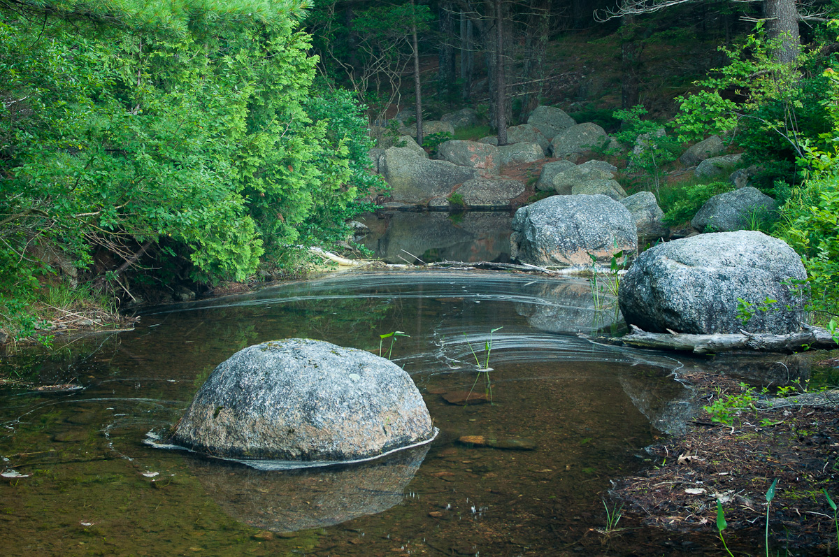
After hiking the Sargent Loop Trail, our whirlwind tour of Acadia National Park continued as I headed back to the hotel for a quick shower, picked up Danelle and the kids, grabbed some lunch at a local Lobster Pound and went back into the park to drive the Park Loop Road.
You have no idea how hard I looked to find the right angle and wait for the right moment to make Sand Beach look deserted. Why I didn't realize that a beach would be crowded on a hot summer day is beyond me.
The drive was nice, but the light in the afternoon was a little harsh
for great pictures. We stopped at Thunder Hole, drove to the top of
Cadillac Mountain and then headed back to town for dinner.
Bonus trip after dinner, and not exactly on the Park Loop Road. But Taryn came with me out to the Bass Harbor Head Lighthouse to shoot the sunset. Well worth the trip.
Back up before dawn and back up to the top of Cadillac Mountain for sunrise. I was bummed when I arrived to see a dozen other cars in the parking lot. By the time I left, the lot was completely full. So this view isn't exactly a secret. But nor should it be -- it's too good for the soul.
We didn't stop at Otter Cliff on Friday. Way too crowded. Not so at 6:00 Saturday morning.
This was definitely a better time to be there. Photographers don't call the hour after sunrise the "golden hour" for nothing.
The warm, low light illuminated the terrain gorgeously.
This was the solitude I had hoped to find on top of Cadillac Mountain. Just me and the waves lapping against the shore.
Eventually it was time to be on my way. But not before one more stop at Bubble Pond, another place we'd skipped the previous day.
Sitting on the shore I heard a call I didn't recognize from just off to my left, but far enough into the undergrowth that I couldn't see what was making it. A few seconds later it was answered from my right. I waited and hoped that their sources would make their way to the water, but they never did. They did keep up their back-and-forth communication for a while, though. And after a little online research I'm convinced that it was a pair of moose. I imagine one was warning the other not to come down for a drink; another nosy human was hanging around. :)
As a photographer I'm always hoping to capture a memorable visual. But Acadia instead chose to give me an audible gift I'll never forget.
Photos from one guy's travels around the world -- from UNESCO World Heritage Sites to national parks to his own backyard in Colorado, and lots of places in between.
Showing posts with label Acadia National Park. Show all posts
Friday, July 26, 2013
Sunday, July 21, 2013
Sargent Mountain Loop
Two years ago when we visited Cape Cod for a week to see my sister and her family, I tried to talk Danelle into tacking on a short jaunt up to Acadia National Park. Not surprisingly, the idea of a five-hour car ride didn't appeal to her and the request was denied.
Planning our return trip this year it had become pretty obvious that this was really the only time we got to the Northeast. And unless we were going to make a special trip out just to visit Acadia, there weren't really any other great opportunities. So after a four-hour plane ride from Denver to Boston we did indeed hop into our rental car and proceed to drive the 281 miles to Bar Harbor, Maine.
First order of business was obviously finding a hike to do. Fortunately, I'd gotten a National Geographic book on The 10 Best of Everything -- National Parks for Father's Day. And right there in the section on the 10 best day hikes was a listing for the Sargent Mountain Loop. The version in the book checked in at 5.4 miles, but I found a 9.5-mile version online that seemed like a better workout. So bright and early at 6 a.m. I was off.
The trail starts on the shore of Jordan Pond, which was a clear sign that this wasn't a Colorado hike for two reasons. First, our hikes tend to end at bodies of water rather than start at them. Second, this would definitely be considered a lake.
I'm not sure exactly what this structure was doing on the trail, or why the door was so far off the ground with no steps leading to it. But I did like the door's texture a lot.
This is for a reader who would like to see the blog's content better reflect its name. You know who you are. :)
Another sign this wasn't Colorado -- moss-covered boulders being used to make a bridge crossing.
We actually do have mushrooms in the Centennial State; so I can't call this more evidence that I wasn't hiking in the Rockies. But I don't think we have this particular kind, which I believe is known simply as a yellow patch.
Once the trail headed up and out of the forest some terrific views to the east came available. For the record, this was a contemplative moment and not a rest stop.
I'm a huge Sisyphus fan. And also clearly a huge dork.
I hit the summit of Penobscot Mountain about two hours in, which seemed like a solid pace.
Next was a saddle over to Sargent Mountain which passed by Sargent Pond. Looked like a great spot to see a moose, but none presented themselves. The view didn't suffer much without them.
In the early 1900s, Acadia trail builder Waldron Bates introduced what is now called the Bates cairn which consists of two large base stones supporting a mantel between them with a fourth rock, known as the pointer rock, resting on top. The pointer rock and base stones point in the direction of the trail.
I was peak-bagging like a boss.
Nothing quite like being able to see so far that the curvature of the Earth becomes apparent.
Like a boss. Though considering something less than 1,000 feet in elevation a "peak" does seem a bit odd.
After descending back into the forest it was just a few more miles and a few stream crossings before I found myself back where I'd started. Roughly 5 1/2 hours to cover the distance, so I wasn't sprinting by any stretch. Carrying the tripod attached to the camera the whole way does seem to slow me down, but the additional flexibility and sharpness it allows in my photos is worth it.
With just over 24 hours to spend in Acadia there was little time to waste. The Sargent Mountain Loop was well worth every minute!
Planning our return trip this year it had become pretty obvious that this was really the only time we got to the Northeast. And unless we were going to make a special trip out just to visit Acadia, there weren't really any other great opportunities. So after a four-hour plane ride from Denver to Boston we did indeed hop into our rental car and proceed to drive the 281 miles to Bar Harbor, Maine.
First order of business was obviously finding a hike to do. Fortunately, I'd gotten a National Geographic book on The 10 Best of Everything -- National Parks for Father's Day. And right there in the section on the 10 best day hikes was a listing for the Sargent Mountain Loop. The version in the book checked in at 5.4 miles, but I found a 9.5-mile version online that seemed like a better workout. So bright and early at 6 a.m. I was off.
The trail starts on the shore of Jordan Pond, which was a clear sign that this wasn't a Colorado hike for two reasons. First, our hikes tend to end at bodies of water rather than start at them. Second, this would definitely be considered a lake.
I'm not sure exactly what this structure was doing on the trail, or why the door was so far off the ground with no steps leading to it. But I did like the door's texture a lot.
This is for a reader who would like to see the blog's content better reflect its name. You know who you are. :)
Another sign this wasn't Colorado -- moss-covered boulders being used to make a bridge crossing.
We actually do have mushrooms in the Centennial State; so I can't call this more evidence that I wasn't hiking in the Rockies. But I don't think we have this particular kind, which I believe is known simply as a yellow patch.
Once the trail headed up and out of the forest some terrific views to the east came available. For the record, this was a contemplative moment and not a rest stop.
I'm a huge Sisyphus fan. And also clearly a huge dork.
I hit the summit of Penobscot Mountain about two hours in, which seemed like a solid pace.
Next was a saddle over to Sargent Mountain which passed by Sargent Pond. Looked like a great spot to see a moose, but none presented themselves. The view didn't suffer much without them.
In the early 1900s, Acadia trail builder Waldron Bates introduced what is now called the Bates cairn which consists of two large base stones supporting a mantel between them with a fourth rock, known as the pointer rock, resting on top. The pointer rock and base stones point in the direction of the trail.
I was peak-bagging like a boss.
Nothing quite like being able to see so far that the curvature of the Earth becomes apparent.
Like a boss. Though considering something less than 1,000 feet in elevation a "peak" does seem a bit odd.
After descending back into the forest it was just a few more miles and a few stream crossings before I found myself back where I'd started. Roughly 5 1/2 hours to cover the distance, so I wasn't sprinting by any stretch. Carrying the tripod attached to the camera the whole way does seem to slow me down, but the additional flexibility and sharpness it allows in my photos is worth it.
With just over 24 hours to spend in Acadia there was little time to waste. The Sargent Mountain Loop was well worth every minute!
Subscribe to:
Posts (Atom)