Showing posts with label Ruins. Show all posts

Sunday, January 17, 2021

Valles Caldera National Preserve

I'd seen a lot of wonderful things during my first two days in New Mexico.  But the whole reason I went was to experience winter, and instead I'd had sunny skies and temperatures in the 60s.

I had one step left.  Everything hinged on Valles Caldera National Preserve.

Valles Caldera National Preserve
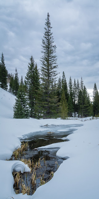
To spoil the suspense right off the bat, Valles Caldera came through!  They didn't simply have snow, but they'd just gotten a fresh inch or two the prior evening.  The view at this vista was broken only by the tracks of earlier hikers.

Valles Caldera National Preserve
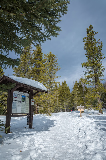
The hike I'd planned for myself was on the Hidden Valley Trail, which fittingly doesn't actually appear on any maps.  A helpful ranger guided me to the trailhead.  The trail has no signage, so I relied on old tracks to guide me.  The only fresh tracks as I looked back were my own.

Valles Caldera National Preserve, Hidden Valley Trail
I was mostly successful working from the old tracks, basically just looking for the most heavily trafficked paths.  That meant crossing and re-crossing a creek that wasn't exactly frozen completely solid several times, and backtracking more than once when what seemed like the right set of prints fizzled out.

Soon enough I reached the trail's namesake valley, which I was somewhat surprised showed no signs of habitation.  The valley was small and secluded yet still easily accessible, with the East Fork of the Jemez River running through it.  Seemed like a perfect spot for a homestead, but then again I'm no pioneer.

Valles Caldera National Preserve, Hidden Valley Trail
I could have hiked up the river all day.  Temperatures were only in the upper 20s, but with the sun shining brightly and not a whisper of wind it was perfectly comfortable.

Valles Caldera National Preserve, Hidden Valley Trail
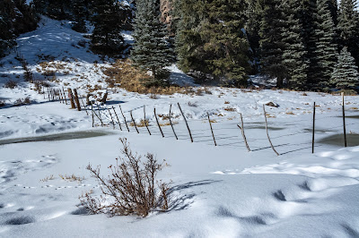
The trail doesn't end at any natural landmark, but rather at a fence marking the boundaries of the preserve. 

Valles Caldera National Preserve, Hidden Valley Trail
I'm not exactly sure how the land outside the preserve is used -- ranching, maybe?  Whatever the case, anyone traveling downriver is made aware when they've reached the preserve.

Valles Caldera National Preserve, Hidden Valley Trail
There were a couple of occasions when I didn't trust the ice to hold me, especially after having sun beaming down on it all day.  I even revised my return route in one spot to cut straight across dry land rather than following the bend in the river.

Valles Caldera National Preserve, Missing Cabin
A great landmark near the trailhead is Missing Cabin, which looks like some old ruins but I believe was actually built for the 2003 movie "The Missing."

Valles Caldera National Preserve, Missing Cabin
It's apparently appeared in a couple of movies, which I can completely understand.  The setting is absolutely gorgeous.

The trail is technically less than four miles roundtrip, but I ended up covering 4.09 because I lost sight of where exactly my car was parked and ended up a couple hundred yards in the wrong direction near the very end of my hike and honestly panicking just a bit.  But I eventually retraced my steps and found my vehicle about 2 1/2 hours after I started.  Burned 460 calories in the process, too!

My short time in Valdes Caldera was the perfect cap to my trip.  It reminded me just how much I like -- and frankly, miss -- winter.  Give me cold and snow over heat and humidity any day!

Friday, January 12, 2018

RMNP: Colorado River Trail

Following an enjoyable if chilly sunrise photo shoot -- and a less chilly but even more enjoyable breakfast at the Fat Cat Cafe -- I headed deeper into Rocky Mountain National Park to snowshoe the Colorado River Trail. Zak had also come along with two of his friends, and they outnumbered me in voting to go only as far as Shipler's Cabins rather than trying to reach Lulu City.

RMNP: Colorado River Trail
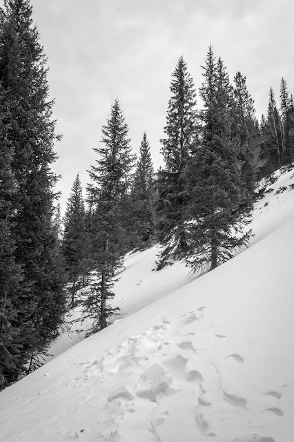
The clear skies of the morning were rapidly giving way to clouds.  The textures apparent on the snow-covered ground were fated to fade far too soon.

RMNP: Colorado River Trail
As we progressed up the trail, we caught glimpses of the river peeking through the modest early-season accumulation of now.

RMNP: Colorado River Trail
Dead wood and me go back a long way.  It still captures my attention.

RMNP: Colorado River Trail
The tracks we'd been following in the snow abruptly ended and we'd seen no sign of the cabins.  Discouraged, we considered turning around.

RMNP: Colorado River Trail
But after some scouting by the boys the trail was rediscovered, and soon we found ourselves at the site of Shipler's Cabins.

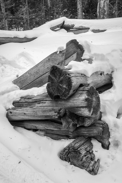
The cabins themselves weren't much of a sight at all.  In fact, we only saw one.  And just part of the frame at that.

RMNP: Colorado River Trail
Engravings in the cabin logs likely came with stories as interesting as the cabin itself.

RMNP: Colorado River Trail
While the clouds on our return to the trailhead and grown thick enough to blanket the entire sky, they at least had some texture instead of being a uniform gray.  That helped provide some picture opportunities.

RMNP: Colorado River Trail
We pulled the car over once for a shot west from the Bowen/Baker Trailhead -- a place I'd like to return to and hike some summer or fall -- then bid our farewell to the park.

Five miles of snowshoeing, and despite the overcast skies the temperatures were fairly warm and the winds were inhibited by the thick trees.  Too brief a visit to be sure, but definitely a pleasing one!

Monday, August 25, 2014

Dunluce Castle, Portrush Coast and Derry

Our final Sunday on the island of Ireland was actually spent in Northern Ireland, which is variously described as a country, province or region of the United Kingdom. I didn't know what to expect from an area that until fairly recently had been embroiled in civil unrest and strife between its Protestant and Catholic communities.  But it had elements that were just as captivating as what we experienced in the Republic.

Dunluce Castle
A visit to Giant's Causeway took up most of our day, and the chance to see that natural wonder was a main reason why we booked this particular trip.  Those images merit their own separate post, which I hope to get to soon.  Along the way we passed the ruins of Dunluce Castle, which dates back to the 14th century and has a magnificent location on a basalt outcropping overlooking the North Atlantic.

Portrush Coast
Dramatic views of the ocean marked the entire area, including this spot along the coast near the town of Portrush.

Bogside
We spent the afternoon in Derry, or Londonderry depending on whether you're Catholic or Protestant.  The city was a focal point of Northern Ireland's civil rights movement, and the place of the tragedy immortalized in the U2 song Sunday Bloody Sunday.  The Catholic population was long segregated to this slum area, known as Bogside.

Londonderry Guildhall
The city boasts an impressive Victorian Guildhall, one of the city's most recognizable landmarks.  It's actually been destroyed twice -- by fire in 1908 and bomb attacks in 1972 -- but rebuilt both times.

Londonderry Guildhall
The building has 23 stained glass windows, most of which represent groups such as carpenters, fishmongers, painters, musicians and glaziers.

Londonderry Guildhall
The Guildhall has a massive pipe organ with more than 3,100 pipes.  As I was processing this picture I inadvertently rotated it 45 degrees and found the diagonal lines made it much more interesting.

I couldn't help but be saddened by Derry's recent history, but also hopeful for its future as relations between the two factions have improved considerably since the end of "The Troubles" in the late '90s.  Christianity has enough problems.  It doesn't need open combat and bloodshed between different denominations to further undermine its primary message of salvation.  The fact that very thing has occurred so often -- not just here -- shows how imperfect people truly are and how powerful and insidious Satan can be.

Saturday, August 23, 2014

Mount Sherman, Take One

It's been more than two years since I climbed San Luis Peak. So when a friend asked if I wanted to join a group climbing Mount Sherman, I figured I was past due to bag another 14er.

Mount Sherman
We got an early start -- met at 5:30 and were on the trail by 7:45.  I was surprised how many other folks had started even earlier, as evidenced by all the parked cars.  It was chillier than I'd expected, too.  But it began to warm up quickly when the sun found a gap in the clouds.

Mount Sherman
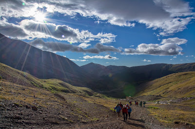
Unfortunately that gap didn't last long, as clouds continued to roll in from the west.  And once we passed this talus field and mining ruins the wind picked up considerably.  Of course I'd neglected to bring gloves or a winter hat.  A fellow coming back down the trail said the winds near the summit were gusting about 50 miles an hour.  He'd stopped short and turned around due to safety concerns.  We decided to press on for now.

Mount Sherman
The pictures make the conditions look much better than they were, since I only stopped to shoot when the sun made a brief appearance.  My fingers were so numb I'd shoved my hands in my pockets trying to get the blood flowing again.  The clouds on the ridge were so thick we couldn't see the summit, and the wind was whipping tiny ice shards at our faces.  Once someone had the guts to suggest that we give up and head back, the notion was quickly approved by the group.

Mount Sherman
Of course, the clouds started to break up once we'd made it back down off the ridge.  But the wind was still blowing just as hard, so we didn't question our decision.

Mount Sherman
The fast-moving clouds did add to the great views on our descent.

Mount Sherman
I'm amazed at some of the ruins of old mining equipment you can find high in the mountains.  It was all I could do to carry my backpack up this high.  It's hard to imagine how people got some of this massive machinery up there, but easy to be impressed at the ingenuity, effort and determination it must have taken.

Mount Sherman
Frankly, the closer we got to being back at the trailhead the nicer the conditions became.  At least, the conditions down at 12,000 feet were nice.  Back up at 14,035 feet, I'm not so sure.

Mount Sherman
The sign we'd made and beers we'd brought to celebrate reaching the summit didn't go to waste.  They looked lovely amidst some remaining wildflowers.  And the beers still tasted pretty good.

Despite not reaching our goal, we had a really fun three hours.  Hopefully we'll get together again for another hike soon!

Wednesday, August 20, 2014

Grass Creek Trail

A fairly short post for a fairly short hike -- Grass Creek Trail in the Mount Evans State Wildlife Area near Evergreen.

Grassy Creek Trail
I was just looking for a quick stretch of the legs that wasn't too much of a drive, but still got me up out of the Denver heat a bit.  The Grass Creek Trail fit the bill on all counts -- four miles out and back, just 45 minutes from home and at 8,714 feet in elevation it was a solid 10 degrees cooler.

Grassy Creek Trail
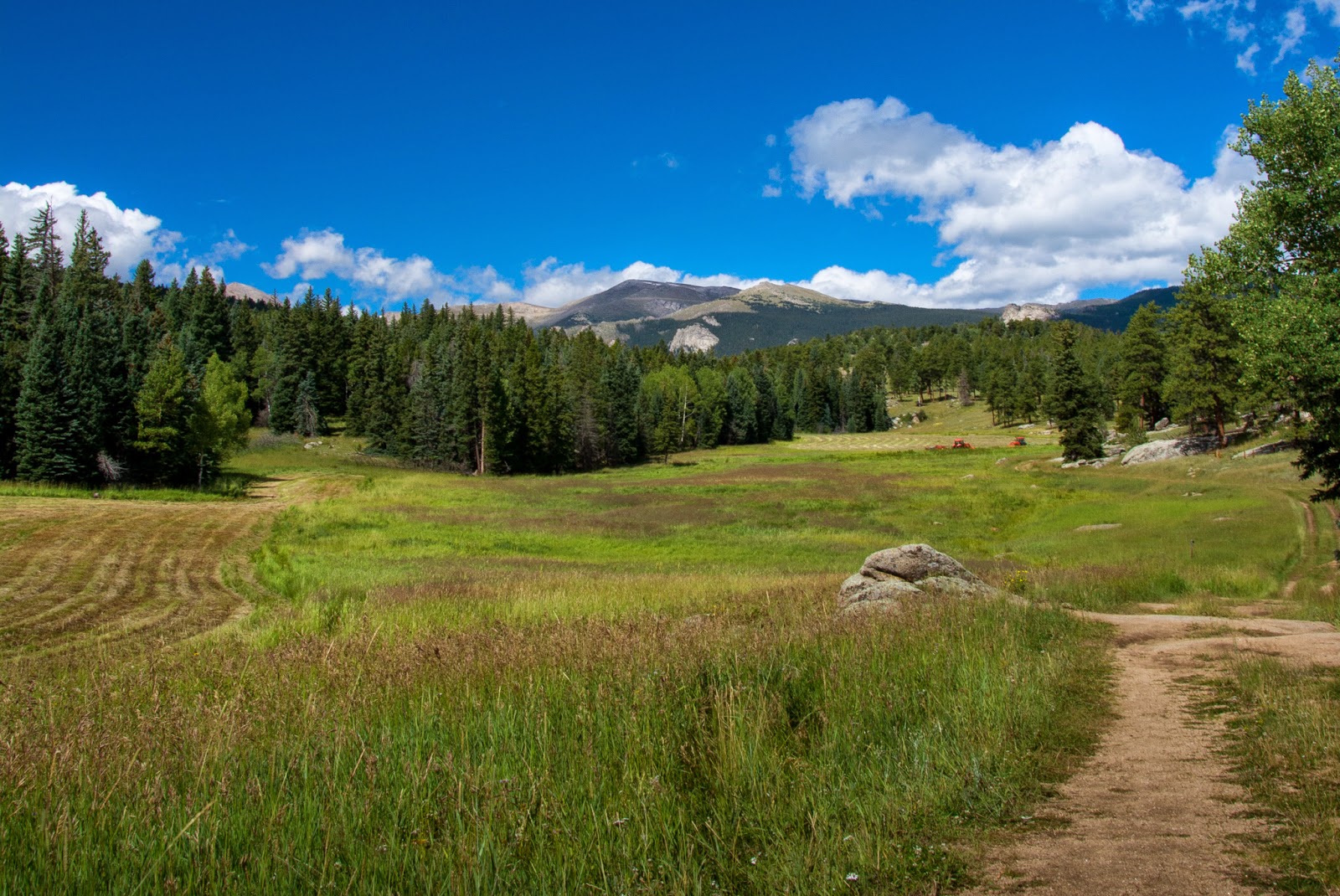
The view along the trail is classic front range -- aspen groves, evergreens, wildflower meadows and big blue skies.

Grassy Creek Trail
The wildflowers aren't going to be with us much longer, though.  I loved the explosion of this thistle already gone to seed.

Grassy Creek Trail
I think every orange-and-black butterfly is a fritillary.  So this is a fritillary, until my friends at BAMONA tell me otherwise.  EDIT: Mike Fisher with BAMONA confirmed its fritillariness -- a Northwestern Fritillary, to be precise.

Grassy Creek Trail
The end of the trail does provide a nice view of Mount Evans to the northwest ...

Grassy Creek Trail
... which is what the residents of this property got to wake up to every morning.  When I see ruins of old homesteads like these I often find myself wondering about the people who built them -- the effort that must have been involved, how much enjoyment they were able to get out of living in such a beautiful area, and what led to the structure eventually falling into disrepair.  I hope they had more good times than bad.

There's not much elevation gain over this hike -- between 400 and 600 feet, depending on which guide you believe.  I was able bang it out in less than two hours, even with a leisurely break at the turnaround to munch a Clif bar.  Definitely one to keep in mind when you have out-of-town guests!

Monday, August 4, 2014

Glendalough and Waterford

We made two stops on our fourth day in Ireland -- Glendalough and Waterford -- before arriving in Cork for the night.

Foxgloves
Our Glendalough stop was at a renowned monastic settlement that dates back to the sixth century.  I was initially drawn to wildflowers like these foxgloves rather than the old structures.  I do need to start remembering to shoo away flies when taking these pictures, though.

Fuchsia
Fuchsia, which apparently came to Ireland from South America.

Saint Kevin's Church, Glendalough
When I did finally focus on ruins like St. Kevin's Kitchen, I still managed to sneak a wildflower in the shot.  Thanks to Danelle for actually suggesting this composition.

The Round Tower, Glendalough
The Round Tower stands about a hundred feet high.  Its top story has four windows facing the main compass points.
Waterford Crystal Factory
The highlight of Waterford was a guided tour of the famous Waterford Crystal Factory.  All the handcrafting that goes into producing each piece was impressive even to Zak and Taryn.

Waterford Crystal Factory
I love how this piece was changing color before our eyes as it cooled.

Waterford Crystal Factory
I don't recall exactly why the pieces get a high-pressure water rinse.  I probably should have been paying closer attention to guide rather than taking pictures.  But I still found the textures and patterns of the water and glass interesting.

Waterford Crystal Factory
The craftsmen who finish the pieces are fantastic artisans.  I wonder if it's distracting for them to have tourists walking by and gawking at them all day.  I guess it's probably like living near an airport -- you eventually tune it out.

Thursday, February 27, 2014

Two Buttes Reservoir State Wildlife Area

The biggest difference I noticed between the High Plains Snow Goose Festival and the Monte Vista Crane Festival was that relatively few of the events at the Snow Goose Festival actually had anything to do with Snow Geese. At least, the two tours I took on Saturday didn't involve them at all. In the case of the afternoon drive to the Two Buttes Reservoir State Wildlife Area, that turned out to be just fine.

Two Buttes Reservoir State Wildlife Area
A couple of Parks & Wildlife staff accompanied us, and explained how two days of torrential rain last fall had burst a hole in the reservoir dam and resulted in a pretty dramatic flash flood.  I was surprised to see thick green algae growing on some of the slow-moving water during winter.

Two Buttes Reservoir State Wildlife Area
The rock formations were reminiscent of Moab, complete with desert varnish.

Two Buttes Reservoir State Wildlife Area
Blue skies and light winds give you blue water with clear reflections.  I'll take that any day.

Two Buttes Reservoir State Wildlife Area
The canyon was surprisingly dramatic and definitely unexpected in the middle of otherwise uniform prairie country.

Porcupine at Two Buttes Reservoir State Wildlife Area
It was these guys that really made the outing worthwhile.  I'd never gotten to photograph a porcupine before, and on this one-mile stretch of trail we saw four hanging out in the trees.  Apparently their predators don't expect to find a canyon here, either.

Two Buttes Reservoir State Wildlife Area
Cliff Swallow nests on the side of one of the rock faces.  A Great Horned Owl had a nest above them, and I assume it never had to travel far for a meal.

Two Buttes Reservoir State Wildlife Area
Dormant cottonwoods doing that awesome dead tree thing, shooting gnarled leafless branches in a jumble of directions.

Black Hole, Two Buttes Reservoir State Wildlife Area
The trail to the area known as the Black Hole was washed out, but that's where having CPW staff with you comes in handy.  They took us back there anyway, and it was easy to see why it's such a popular swimming spot for local young folks in the summer.  The water is apparently 60 feet deep in spots.

Two Buttes Reservoir State Wildlife Area
This shape on the far wall caught my eye.  I guess it's not a cave entrance, which would have just made the spot that much cooler.

Two Buttes Reservoir State Wildlife Area
More recent ruins.  The trailer had an equally decrepit washing machine inside it.

Robin at Two Buttes Reservoir State Wildlife Area
The birders in our group -- which was most of the group -- got very excited about a grosbeak sighting.  The bird apparently didn't really belong in Colorado this time of the year.  I missed the grosbeak, but shot this robin instead and was just as happy.

Spent a really terrific couple of hours here, but didn't actually get a picture of the namesake geographic feature!