Monday morning of my spring break trip with Zak brought with it a change of venue. After two nights in Carlsbad we packed up and headed to the town of Terlingua. But we stopped for one more hike in Guadalupe Mountains National Park along the way -- a simple 2.3-mile loop to Smith Spring, a sheltered oasis in a patch of oak woodland at the foot of Frijole Ridge.
The parking lot was empty when we arrived just after golden hour. We had the trail to ourselves, and a different view of El Capitan from the previous afternoon.
This conical formation fascinated me. I can't find a name for it anywhere. Given its prominence relative to its surroundings, you'd think it would merit one.
The trees near the trailhead had at least half a dozen male and female Western Bluebirds. Our first real wildlife sighting of the trip!
This fellow was more comfortable with me than his comrades, most of whom flew off when I started clicking away. He gave me a few different poses before also changing trees.
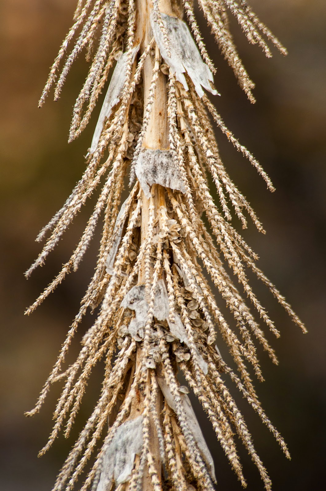
I should have asked more questions at the visitor center about the flora. I don't know what these dead blossoms are, but I loved their intricacy.
Smith Spring is pretty small, but still by far the biggest body of water I'd seen in the area. Fed by one small cascade it was a quaint little oasis in the arid land.
The roots of this tree near the water's edge looked like they'd seen a thing or two in their time. Reminded me of Yggdrasil, the "world tree" from Norse mythology.
I liked how the morning light illuminated these dead branches. I can just get lost in an image like this, following all the various lines with my eyes.
Something else I wished I'd asked about -- exactly what cactus was starting to bloom with yellow flowers. My online research hasn't yielded anything definitive. Just some references to prickly pear, which I suppose is possible.
EDIT: I got some help from park ranger Michael Haynie, identifying what are actually fruit and not flowers. :)
The cactus in question is a cholla and that was last year's fruit you
were seeing. They will have huge magenta blossoms in late May and June.
The fruit forms later and is yellow as you saw. Many people mistake it
for a flower, but it does contain seeds. They are not juicy as the
fruits of prickly pear and they are very spiny. Not recommended for
tasting!
Manzanita Spring was bigger and closer to the old Smith homestead. And along the same line of sight to El Capitan as the trailhead. Other than some spiders in the dead grass there wasn't any real activity here, either. But still a nice reflection.
We didn't dawdle too much on this walk -- just a couple of hours in all. Big Bend National Park was calling, and we still had a four-hour drive ahead of us. The bluebirds alone made this worth the stop, though!
Photos from one guy's travels around the world -- from UNESCO World Heritage Sites to national parks to his own backyard in Colorado, and lots of places in between.
Showing posts with label Culberson County. Show all posts
Showing posts with label Culberson County. Show all posts
Wednesday, March 25, 2015
Smith Spring Trail
Topics and References:
Birds,
Culberson County,
Guadalupe Mountains National Park,
Hiking,
Photos,
Texas,
Winter
Monday, March 23, 2015
Devil's Hall Trail and El Capitan
After a few hours underground in the Big Room of Carlsbad Caverns, Zak and I needed some fresh air. So we headed half an hour south and crossed the state border to Guadalupe Mountains National Park in Texas. After chowing down on some Fluffernutters and filling our water bottles, we hit the Devil's Hall Trail for a good old-fashioned outdoor hike.
The trail starts right at the visitor center parking lot, leading first into the campground then splitting up between the peaks and the canyon.
The tall desert plants were interesting studies in texture and pattern to me.
Being just a couple of weeks before the official start of spring, we saw a mix of plants that were already green and blooming and others that weren't so much.
The trail starts pretty typically, making a gradual ascent along the side of Guadalupe Peak. Then it descends into Pine Spring Canyon and gets pretty fun as you pick your way along a stony streambed filled with large boulders. Many cairns help mark the way, though I'm not sure they're all that necessary. You pretty much just keep following the canyon.
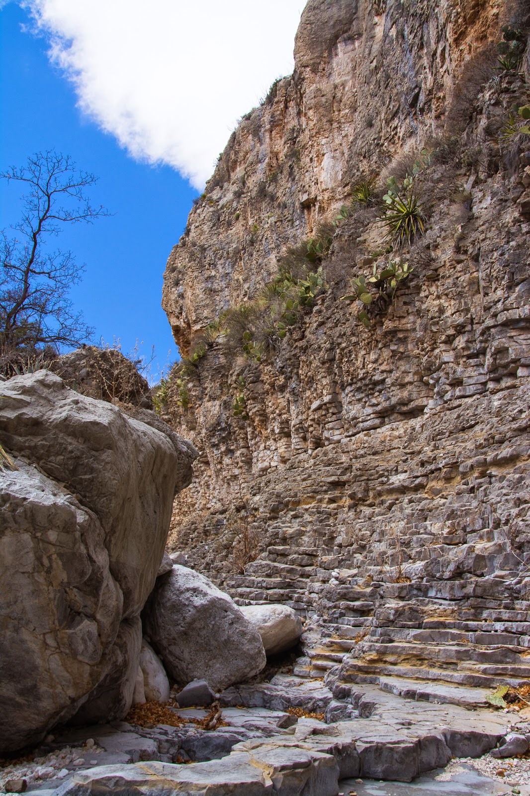
The Hiker's Staircase is a gorgeous natural feature that resembles carved steps. They're actually pretty steep and a bit tricky to get up, though. I found it easier to go around the left side, and advised the gentleman with the walking stick to do the same.
There are actually two "flights" of stairs in the limestone walls. I've never run into anything else quite like them.
The official end of the hike is here at Devil's Hall, a narrowing in the canyon where the walls are just 15 feet apart.
But the canyon continued on, so Zak and I decided to keep going. After a while we checked a map and realized the canyon continued for at least another couple of miles, with no particular payoff marked. So we took a brief Clif Bar break and began to head back.
The hike covered about five miles counting our little extension at the end. We covered it in a fairly leisurely three hours. Even though you're technically ascending the whole way, there's only about 750 feet of elevation gain. Navigating the boulders in the canyon is the only strenuous part, and that's still relative. The manageable distance and interesting mix of landscapes make it easily one of the more enjoyable National Park hikes I've ever done.
Despite thick clouds and the start of some rain, since sunset was still a few hours away we drove a couple of miles farther down the road to a scenic overlook of El Capitan that the ranger at the visitor center had recommended. Turned out to be a good decision, as the late afternoon sun soon dipped below the clouds and lit up the peak nicely.
In a classic "small world" moment another photographer soon joined me and set up his tripod as well. We got to chatting, and it turned out he was a high school journalism teacher from Dallas who had made a career switch into teaching and taken the alternative certification route. I pumped him with questions, and felt refreshingly validated about making a similar decision of my own. And we got an awesome view. :)
At the scene, I thought including the boulders in the foreground made for the best shot. Now I think they compete with the peak too much.
Eventually the clouds thickened again, and after forcing Zak to sit here for a couple of hours already with a dead cell phone decided to gamble against there being any color in the actual sunset and make the drive back to Carlsbad. From what we could tell in our rear view mirror, that seemed to be the right call. Fortunately, we'd gotten some very nice views already!
Topics and References:
Culberson County,
Guadalupe Mountains National Park,
Hiking,
Photos,
Texas,
Winter
Subscribe to:
Posts (Atom)


