Dead Horse Point State Park was Sunday's appetizer on our Utah trip. Canyonlands National Park was the main course. Well, at least the Island in the Sky part of the park was. The park has three main areas, but because they're separated by the namesake canyons it's a long drive around from one to the other. As they say back where I was born in Vermont, "You can't get there from here."
Upheaval Dome was our first stop. A short, steep trail leads to a very odd feature, which isn't a dome at all but more of a crater. Majority opinion among geologists seems to be that it was created by a meteor impact. But there are other theories as well. Sadly, none of them seem to involve ancient aliens.
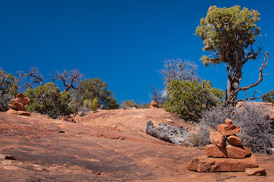
Taryn and I were looking to stretch our legs even more, so next we sprinted up Whale Rock. Cairns were prominently and frequently placed, which is a pretty good idea on a trail that doesn't really allow for footprints.
We saw a number of odd-shaped holes in the rock that I swear were dinosaur footprints. See the toes? But the park brochure and trailhead sign made no mention of them.
I don't really know how to explain it, but the vistas just never got old. Most of the overlooks marked on the map didn't even have corresponding signs along the road. I'm pretty sure this is the Holeman Spring Canyon Overlook.
The Green River Overlook, which was noteworthy for looking like a canyon within a canyon. There was a sharp dropoff down to the Soda Springs Basin, which extended for at least five miles, then another steep drop down to the river.
Candlestick Tower Overlook, which I assume was named for the formation in the distance. But again, no signage to be sure. I guess you can't mark them all.
Monument Basin from Grand View Point Overlook. The White Rim Road runs along the aptly named White Rim.
Mesa Arch was our final real walk. The span is about four feet wide, and the drop on the far side goes straight down to the canyon floor. But that didn't stop most visitors from walking across it, including me and Taryn.
The view through the arch was stunning, and something you don't really get from the features at Arches National Park.
The Shafer Canyon Overlook, with the 4WD Shafer Trail Road clearly winding its way down. We saw a few small caravans of jeeps slowly crawling along.
Just when we thought we were out of things to gawk at, Monitor and Merrimac Mesas gave us one final spectacular sight driving back to Moab. The features do indeed resemble the Civil War ironclads after which they're named.
I wasn't sure how different Canyonlands would be from Arches. The two parks are only separated by about 10 miles as the crow flies. But they're really not much alike at all, each stunningly beautiful in their own way. Makes me that much more anxious to get to Capitol Reef, Bryce Canyon and Zion someday!


No comments:
Post a Comment