Yesterday I broke from the Boulder County hiking routine I've been in for the past six months and headed west on I-70 to Silverthorne. Ultimate destination: Willow Falls.
The trailhead is easy to get to. But I always find obvious signs of civilization like telephone poles annoying. Views of Silverthorne to the east stay with you for about a mile or so, too. Not exactly "getting away from it all."
Fortunately you do get to actual wilderness fairly soon. The Eagles Nest Wilderness, to be specific.
I've come across lots of fallen trees blocking lots of paths. But never ones I couldn't easily climb over or walk under. These two put me on my hands and knees on the way out, but I went with a low Groucho Walk on the way back instead.
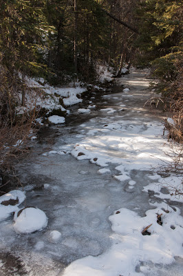
South Willow Creek was almost completely frozen over. Only a few visible areas of running water remained close to the banks.
The forecast called for some moderately high winds, but they seemed to be limited to the upper atmosphere. The scattered clouds zoomed by pretty fast, while things were nice and calm at ground level.
The approach to the gorge between Buffalo Mountain and Red Peak is really striking. You're teased with glimpses through the trees for a while before things open up to an inspiring view that really motivates you to make the final push to the falls.
The falls themselves might have been more dynamic a week or two earlier when there was a little less ice. But even now they're a worthy payoff for the effort.
Drips become icicles that become columns that eventually become a frozen sheet. Caught at the right time, they're nothing less than art.
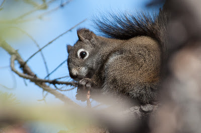
An eight-point mule deer buck caught me unawares, ambling right towards me ahead on the trail coming over a small rise. He veered off into the brush before I could get a picture, and I was never able to get another clear shot before he was out of sight. This chickaree, however, I had dead to rights. He didn't mind me snapping away as long as I didn't interrupt him from chowing down on whatever he was eating.
The route is a solid 8.75 miles out and back, but with less than a thousand feet of elevation gain. Even with a 30-minute photo stop at the falls I made it back to the car in 4:06, aided by jogging a few stretches that weren't too steep or icy on the return trip. A nice return to Summit County!


No comments:
Post a Comment