 The biggest challenge in taking pictures of the canyon was the sharp contrast between the sunlit areas and the shaded ones. But that same contrast also made some shots more dramatic.
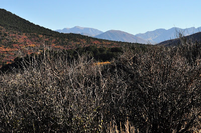
 The West Elk Mountains provided a nice backdrop to the fall colors on the canyon's north rim.
 While it's not the deepest canyon in the country, the narrow walls and sheer cliffs make it one of the steepest. At its narrowest point the canyon is only 40 feet across at the river.
 I didn't see any wildlife other than a few birds and one rabbit, but I did find this evidence that some predators had been in the area. So I had that going for me.
 I had a pretty good idea what this sign was trying to say. I didn't go past it.
 The pictures pretty much speak for themselves, but even so they don't come close to capturing what it felt like to actually be there.
 Vertigo, anyone?
 In some spots it was hard to even make out the bottom.
 The greatest descent of the Gunnison River occurs in the park at Chasm View, dropping 240 feet in just a mile.
 Did I mention how much the fall colors added to the already impressive views?
 Looking east from Tomichi Point, you can see the canyon continue upstream into the Curecanti National Recreation Area.
I spent four hours from the time I got to the park to get back to the Visitor Center, stopping at every one of the nine overlooks between it and Warner Point. Right on schedule for the other activity I'd planned for the trip, and the one that discouraged me from bringing either of the kids -- hiking the inner canyon, down 1,800 feet to the river via the Gunnison Route. Those photos are coming soon!
Click here for South Rim Road, Part I.
2 comments:
Beautiful pics. I'm jealous. I think I started planning a trip to Black Canyon way back when. Now I remember why...
You should absolutely go. Just a five-hour drive from Denver, and there was almost nobody there the day I went. I only passed about 10 cars the entire morning driving between the overlooks, and only four other people on my hike.
Post a Comment